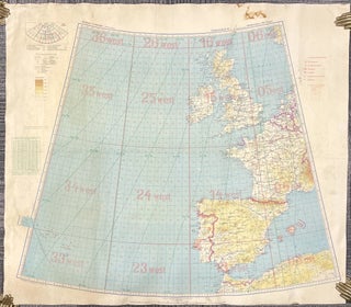
Item 2785Luftwaffe Map of Western Europe and the Balkans, 1941
World War Two double-sided aerial map depicting Western Europe and the Atlantic Ocean (side 1) and the Eastern Balkans (side 2). Printed on treated canvas from a conical projection at a scale of 1: 400000. Originally published by the Generalstab der Luftwaffe (German Air Force General Staff) in 1940, this.....


